Use of GLAD Alerts Led to 18% Reduction in Deforestation in Monitored African Forests
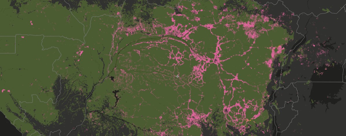
GLAD deforestation alerts in Central Africa, 2015-2020.
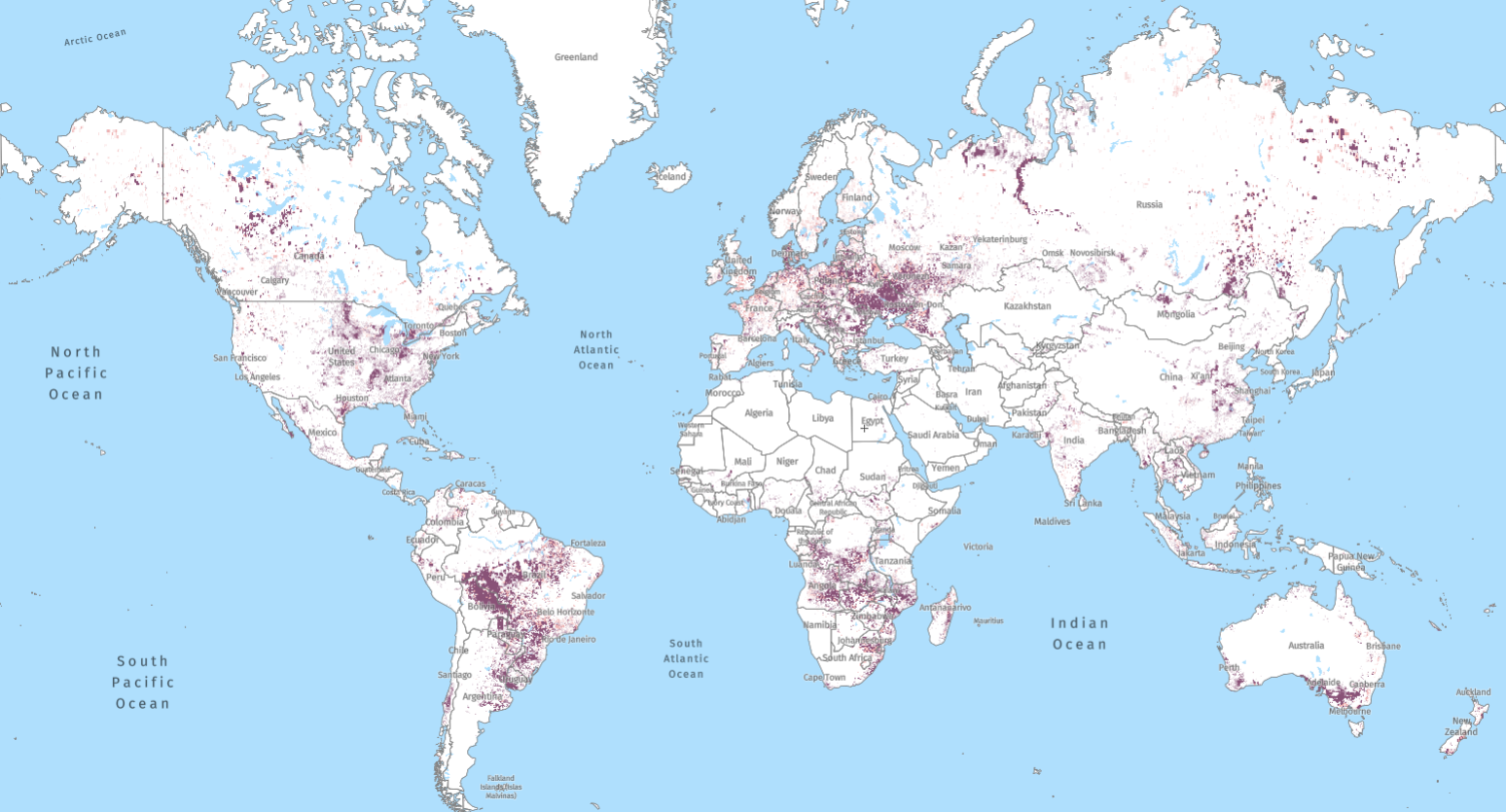
Whether from rangers in Uganda, civil society groups in Madagascar, environmental police in Brazil or Indigenous communities in Peru, we’ve had anecdotal evidence for years that improved data transparency is vital to reducing deforestation. Now, research lends empirical evidence to that claim. A new study from researchers at Global Forest Watch (GFW), the University of Maryland, Oregon State University and the University of Wisconsin investigated the rates of deforestation in regions of Central Africa where forests were being actively monitored with satellite data, and found that active monitoring lowered deforestation by 18%.
This finding provides evidence for the theory that when forest monitors and decision makers have access to credible, timely information about forest change, they are better able to intervene to prevent further deforestation.
Active monitoring deters deforestation
The study applied econometric analysis to areas monitored through the GFW platform to test two hypotheses. The first was that the availability of near-real-time deforestation alerts (GLAD alerts) through the GFW platform would drive down national deforestation rates in countries where they are available. When countries that had early access to GLAD alerts were compared with those that gained access later, no significant difference was found between the two.
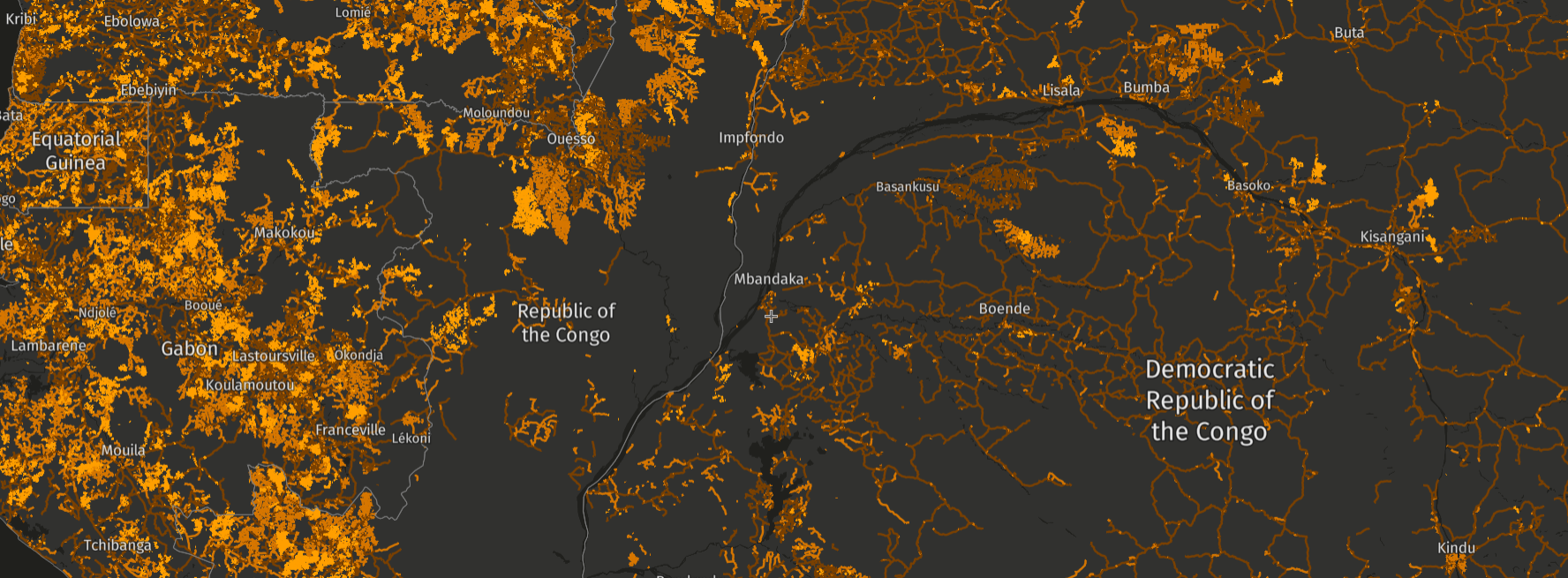
The second hypothesis asked whether the active use of alerts —approximated by the use of the MyGFW subscription system — would affect deforestation in the areas being monitored. When this analysis was conducted for regions in Central Africa, the results revealed an 18% drop in deforestation for areas of active monitoring. Within the study area, the use of GFW contributed to 50,000 hectares (495.27 square kilometers) of avoided deforestation per year — an area roughly 3 times the size of Washington, DC. The study was designed to find the minimum possible effect of the alerts, which means the true impact is likely even greater.
On average across the tropics, monitoring contributed to reduced deforestation, but Central Africa was the only region in which the results held statistical significance. The results in Africa are most likely the strongest due to the lack of other forest monitoring options— GLAD alerts were one of the first, and remain one of the few, monitoring technologies for the region. In other regions like South America, alternative monitoring platforms could have reduced the signal of the GFW platform in the data. In Asia, usage of GFW may yet be too limited to detect an impact.
Monitoring systems are a supplement to strong policy
The study also found that the decrease in deforestation was higher within protected areas and concessions. This suggests that GLAD alerts are particularly effective for enforcing existing deforestation policies, reinforcing the idea that data alone is not enough. Integrating strong policies with reliable monitoring systems may be a critical step towards measurably reducing deforestation.
Of course, people are more likely to be monitoring forest change in areas where deforestation is likely to happen, especially in places like protected areas, so separating this type of “hotspot-watching” from “monitoring with an intent to act” was critical for understanding how data plays a role in reducing deforestation. For this reason, users were separated by their self-described roles— be that researcher, park ranger or another party subscribed to deforestation alerts through MyGFW— and only users considered to be monitoring “with intent” were included in the study.
Other factors that influence deforestation, like altitude, soil type, distance to roads or ports and macroeconomic trends were controlled for in order to isolate the effects of monitoring on deforestation. Further research will be able to improve on this methodology to assess the impact of other monitoring tools, like GFW Pro.
For years, people on the front lines of forest loss have relied on transparent data to fight deforestation. This research shows that tools like GFW can make a difference when properly implemented. Above all it shows that reliable, up-to-date data on forest change is a critical weapon in the fight against deforestation.
Explore More Articles
Looking for the Quickest Signal of Deforestation or Vegetation Disturbance Globally? Turn to GFW’s Integrated Disturbance Alerts
GFW’s integrated alerts layer combines the power of four alert systems for an improved view of deforestation and other vegetation disturbances globally.


