Near-Real-Time Disturbance Alerts for All Vegetation Globally are Now Available on GFW

Global Forest Watch’s (GFW) deforestation alerts provide information about loss of trees in near-real-time, making them a critical tool for those working to combat deforestation. Existing alerts on GFW have been used to help Indigenous and local communities protect their forests, halt and prosecute environmental crimes and protect threatened wildlife.
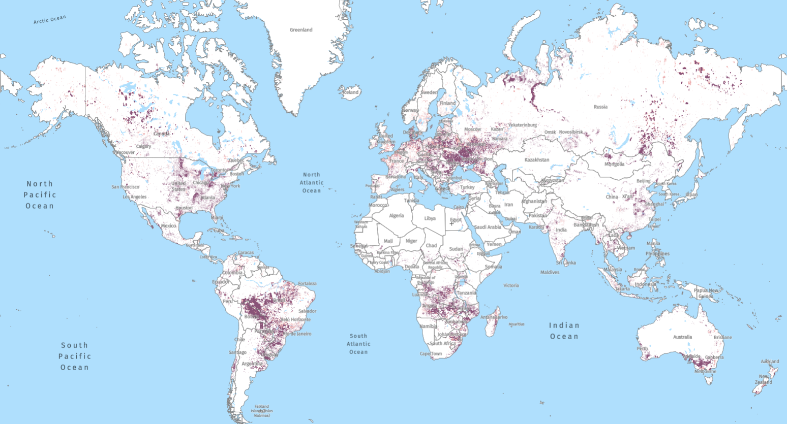
But previously, alerts were only available for tropical forests. Now, a new alert system available on GFW called DIST-ALERT provides alerts within forests globally as well as alerts where other ecosystems are disturbed — such as grasslands, savannas, shrublands, wetlands and crops. This new global data set makes it possible to monitor deforestation and other vegetation disturbance events as they happen around the world for the first time.
Read on to learn more about the new DIST-ALERT, how it’s different from other alerts and what’s next for alerts on GFW.
What are the new disturbance alerts?
In 2024, a groundbreaking new land surface disturbance monitoring system known as OPERA Land Surface Disturbance Alert, or DIST-ALERT, was developed by the University of Maryland (UMD) and NASA’s OPERA project to map per pixel vegetation cover loss globally at a 30×30-meter resolution. The DIST-ALERT algorithm uses Harmonized Landsat Sentinel-2 (HLS) satellite data that is updated every 2-4 days for each pixel on the earth, and thus the system is updated every time the satellite data is acquired and the ground is not covered by clouds or snow (read more here about how DIST-ALERT was developed and the methodology behind it).
DIST-ALERT shows an alert when there is an anomaly or notable reduction in vegetation cover, measured as “vegetation fraction” or percent of the ground covered by vegetation. It identifies this by comparing the new vegetation fraction estimate to the minimum fraction for the same time period over the last three years. This means that the algorithm can accommodate changes to seasonal vegetation without triggering an alert.
What new alert data is available on GFW?
The new DIST-ALERT system on GFW updates weekly and tailors the vegetation fraction level to only display alerts in areas that experience at least 30% vegetation cover loss compared to the same period over the last three years.
DIST-ALERT on GFW also provides information about the level of confidence for alerts. The system determines confidence level by the number of anomalous observations, with more observations meaning a higher confidence level. That is, two to three anomalies detected result in a low confidence alert, whereas four or more mean a high confidence alert. Since the system continues to detect anomalies in a pixel over time and the underlying algorithm is updated every 2-4 days (in cloud free conditions), this means that an alert can quickly move from lower to higher confidence, providing users with more timely and more confident alerting than ever before.

Like other alerts on GFW, users can also explore DIST-ALERT locations with the Forest Watcher mobile app, which allows users to investigate potential deforestation events and other disturbances in the field and offline.
How does DIST-ALERT differ from existing alerts on GFW?
GFW’s existing integrated deforestation alerts are only available in tropical forests. Now, DIST-ALERT makes it possible to view alerts for all types of tree and vegetation cover, including grassland, shrubland, agricultural land, savannas, temperate forests and boreal forests.
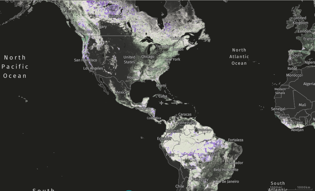
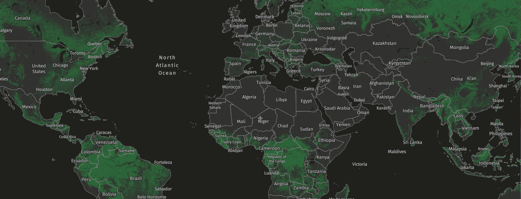
Users can also choose to only view alerts within areas of tree cover with at least 30% canopy density across the globe. Disturbances in forests with 10-30% canopy cover are difficult to identify with this product because anomalies can be driven by disturbances of any vegetation in the pixel — for example, disturbances of undergrowth where trees remain intact. For this reason, we provide the option to view alerts where tree cover disturbances are more likely to be driving the anomalies: within areas of 30% tree canopy density or above.
In contrast to many other alert systems available on GFW, DIST-ALERT continues to monitor pixels where it has identified an alert in the past. The layer on GFW shows the date of the most recent alert, keeping users informed of the most up-to-date changes to forest and vegetation cover.
| System | Geographic coverage | Resolution | Revisit time | Vegetation type | Alert description | ||
| DIST-ALERT (Land Surface Disturbance Alert from Harmonized Landsat Sentinel-2) | Global | 30 meter | Every 2-4 days | All vegetation (and recommended for forests: tree cover >30%) | Vegetation cover loss >30% compared to the same period over the previous 3 years in each HLS pixel | ||
| Integrated Alerts (combines GLAD-L, GLAD-S2 and RADD) | Tropics —30°N to 30°S | 10 meter | Upon source systems’ updates (GLAD-L, GLAD-S2 and RADD) | Tree cover – including primary forests, plantations and secondary forest | See contributing systems (GLAD-L, GLAD-S2 and RADD) | ||
| GLAD-L (Global Land Analysis and Discovery – Landsat) | Tropics — 30°N to 30°S | 30 meter | Every 8 days | Tree cover – including primary forest, plantations and secondary forests | Any pixel that experiences a canopy loss in excess of 50% cover | ||
| GLAD-S2 (Global Land Analysis and Discovery – Sentinel-2) | Amazon basin | 10 meter | Every 5 days | Humid tropical primary forests | Reduction in tree cover compared to the previous 2 years | ||
| RADD (RAdar for Detecting Deforestation – Sentinel-1) | Humid tropics | 10 meter | Every 6-12 days | Humid tropical primary forests | Complete or partial removal of tree cover, with a minimum mapping unit of 0.1 hectares. Use of radar detects disturbances through clouds. |
GFW also hosts the VIIRS fire alerts. Like DIST-ALERT, these monitor all land, but they differ from DIST-ALERT because they only monitor fire activity, have more frequent temporal resolution (2 times daily) and a coarser spatial resolution (375 meter).
What can the new alerts tell us?
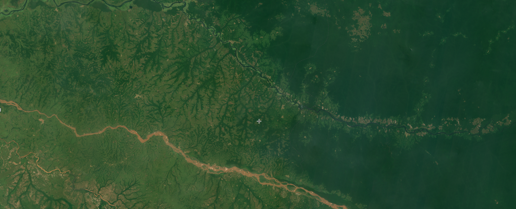
The DIST-ALERT data shows changes within both natural and human-managed vegetation cover. These changes may be driven by human activities like agricultural conversion, or natural causes like drought damage in crops, and may be temporary or permanent. Therefore, an alert in tree cover area is not necessarily deforestation, and one in grasslands or savannas is not necessarily conversion to another land use such as agriculture.
In addition, because the alerts are available in near-real-time, they are often available before any change in land use, like conversion to agriculture, has occurred, and before replanting might have happened in areas where forestry activities are taking place, meaning further investigation may be needed to understand the context of the alert.
While this new system is incredibly powerful, detecting any loss of vegetative cover anywhere on earth continuously, not all changes are equally interesting and useful to track. Additional information such as whether the alert is in a natural or non-natural ecosystem can be used to identify alerts that warrant further action. Here are two examples of how the data may be useful:
1. Supply chain actors can monitor for no-conversion voluntary commitments and regulatory requirements: Suppliers looking to ensure and demonstrate sustainability in their supply chains and that have made no-conversion commitments for natural lands (e.g. the Accountability Framework Initiative goal) can use DIST-ALERT to monitor areas outside of forests. The data is also relevant to the European Union’s deforestation regulation (EUDR), providing information on potential deforestation or degradation. In addition, while the EUDR’s scope is currently limited to conversions in forests, it could potentially expand to “Other Wooded Land” (non-agricultural land with few trees that can include shrubs and bushes). This expansion would require identifying conversion of this land cover to cropland, which DIST-ALERT could support.
2. Land managers can identify threats to natural ecosystems: DIST-ALERT can provide early information about other worrying trends in the world’s natural ecosystems, such as the impacts of droughts and climate change. By tracking alerts within valuable lands such as protected areas, biodiversity hotspots and Indigenous lands, and crosschecking with other information such as weather anomalies or fires, land managers could better tell what’s going on in these areas to identify threats and support their decision making. The global biodiversity framework includes the ambitious “30×30 initiative,” which aims to protect 30% of the planet’s land and water by 2030. Alerts within these protected areas could indicate threats to their long-term conservation and provide an early warning that swift action should be taken to reverse this trend.
What’s next for DIST-ALERT on GFW?
The new DIST-ALERT layer provides more near-real-time information about disturbances in the world’s vegetation than ever before, but there is still more to come.
In future, GFW will have additional features to support DIST-ALERT such as on-the-fly analysis (e.g. number of alerts) in an uploaded or drawn area, the ability to subscribe to email alerts, and the ability to download alert coordinates. We will introduce these items in the coming months, but in the meantime, users can overlay layers available on GFW such as primary forests and protected areas and view together with DIST-ALERT to provide context and support decision making.
We also plan to add information about what is causing alerts. This information will help users understand if the alerts are caused by natural disturbances or human activity, and inform decisions about what kind of action might be required. Land and Carbon Lab is developing an alert classification system to create targeted alert products that can be used to distinguish between human-caused conversion of natural lands to other land uses like agriculture, mining or urban development, as well as natural disturbances like drought and wildfire. A prototype is currently available for testing and users can register their interest and gain access by completing this survey.
Lastly, DIST-ALERT is not yet incorporated into GFW’s integrated deforestation alerts, but we are working hard to add it in the near future so users can benefit from improved and expanded alert systems, all in one place. Adding the DIST-ALERT layer to the integrated deforestation alert product means that more timely and confident alerts will be available for users, and will enable having a “highest confidence” category where two or more systems detect an alert in the same pixel, and alerts are therefore more certain.
We welcome your input as we continue to improve the new DIST-ALERT data. Please fill out a short survey to provide your feedback.


