- Data
3 Ways Global Forest Watch Can Support the EU Law on Deforestation-free Supply Chains
Jun 23, 2023||10 minutes
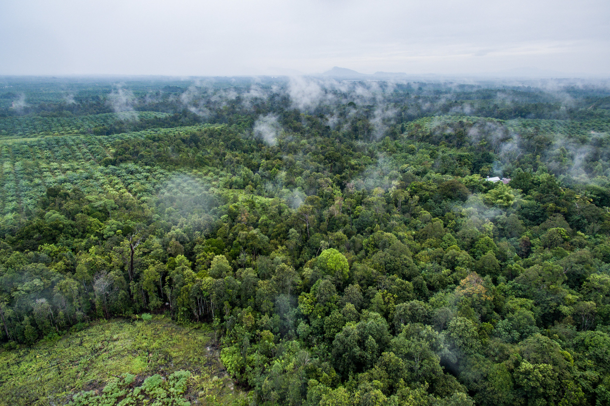
Oil palm plantation
-Agus Andrianto/CIFOR
This blog is part 1 in a two-part series, and explores how GFW data can help monitor for deforestation under the EUDR. Read part 2 on degradation here.
In May 2023, the European Union (EU) adopted a regulation that aims to prevent products and commodities linked to deforestation and forest degradation from being sold in the EU, thereby supporting global efforts to mitigate climate change such as the Paris Agreement and pledges to halt deforestation and degradation made at COP26. Under the EU Deforestation Regulation (EUDR), companies must show that commodities placed on the EU market are deforestation- or degradation-free.
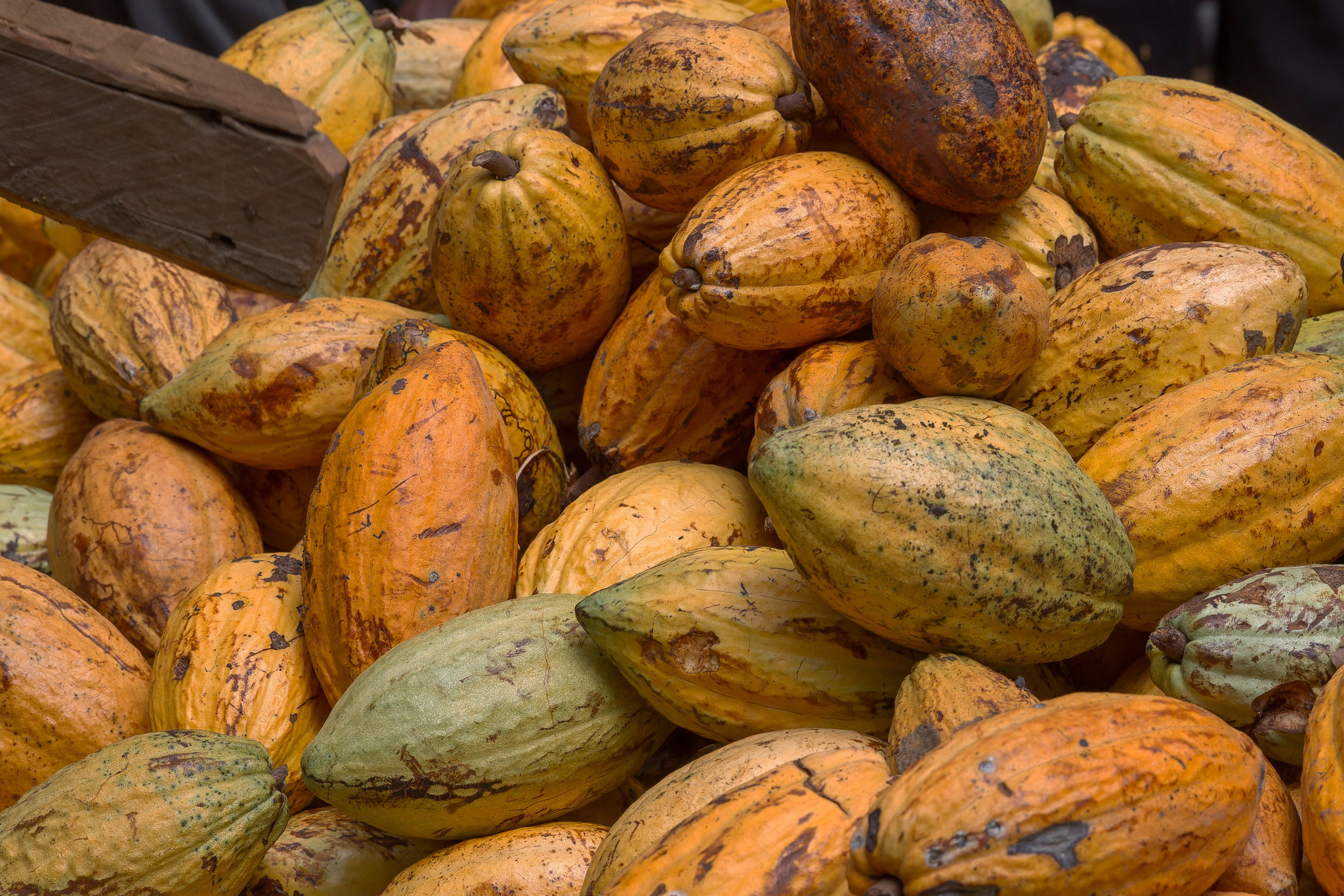
The EUDR has a cut-off-date of December 31, 2020, meaning that products and commodities linked to deforestation or forest degradation after that date are not permitted in EU markets. The commodities required to be deforestation-free are cattle, cocoa, coffee, palm oil, soy and rubber, as well as derived products such as beef and chocolate. Wood and derived products such as furniture must also be degradation-free. (Although rubber is included with the Food and Agriculture Organization of the United Nations [FAO] definition of a forest, under the EUDR it is considered an agricultural commodity and as such is required to be deforestation- rather than degradation-free.)
To ensure all covered commodities — both imported and domestically produced — are in compliance with the regulation, companies need to monitor supply chains globally to cover any area where commodities that enter the EU market are sourced. The EUDR requires suppliers to provide the geocoordinates of plots of land where relevant commodities and products were produced, and to provide due diligence information for all these locations.
In this blog, we explore the regulation and describe relevant data and tools — specifically those available on Global Forest Watch (GFW) — that companies, governments and others can use to establish whether commodities are deforestation-free, while highlighting areas where new data can improve assessments in the future. We discuss how satellite data can support three monitoring needs: 1. Setting a forest baseline; 2. Tracking deforestation; 3. Mapping commodities.
Before discussing these monitoring needs, we first explore why satellite data is useful.
Why is satellite data important for monitoring the EUDR?
Forest-related satellite data, such as that available on GFW, allows forests everywhere to be monitored remotely from anywhere in the world. Commodities included in the regulation span large areas, meaning it is not possible to visit every location on the ground. Additionally, historical satellite data shows the status of forests before the cut-off-date.
The EUDR provides definitions of key concepts, such as forest, deforestation and agriculture, which largely follow the United Nations Food and Agriculture Organization’s (FAO) definitions. Taken at face value, the definitions used in the EUDR and those used by satellite derived data do not exactly match up. Satellite derived tree cover data is based on biophysical metrics, such as tree height and canopy density, while FAO definitions also use land use criteria. Data users must take steps to match the definitions derived from satellite information to the definitions set out in the EUDR more closely, and we discuss these steps for three monitoring needs:
1. Setting a forest baseline
Understanding the extent of forests as of December 31, 2020, is crucial since the EUDR requires that commodities cannot be sourced from areas that were forested before the cut-off date. The EUDR defines “forest” as: “land spanning more than 0.5 hectares with trees higher than 5 meters and a canopy cover of more than 10%, or trees able to reach those thresholds in situ, excluding land that is predominantly under agricultural or urban land use.”
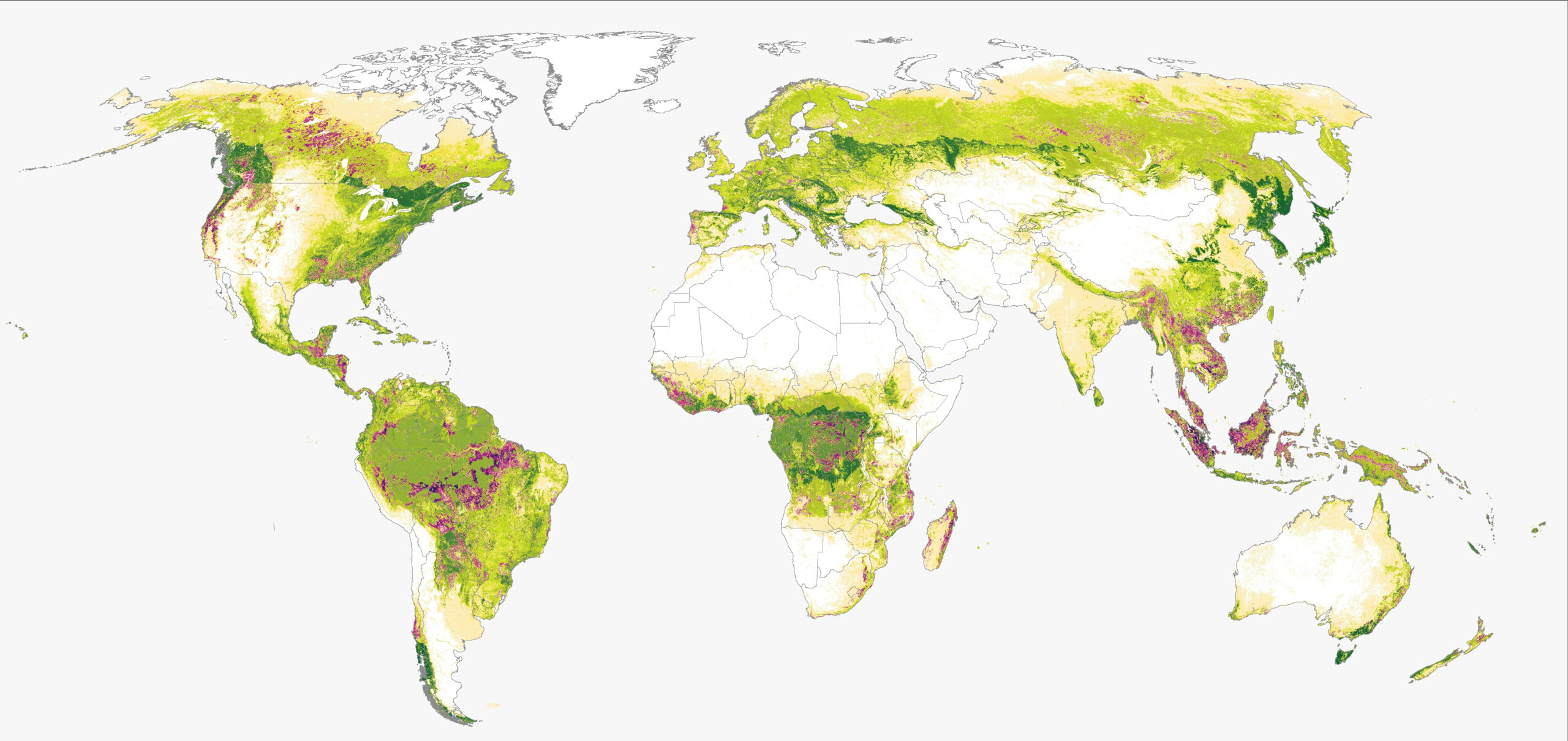
The tree cover height data available on GFW from the University of Maryland (UMD) is a reasonable proxy. This global data set shows the height of trees (defined as woody vegetation) taller than 3 m within 30-m pixels in the years 2000 and 2020. To better match the EUDR definition, one can apply a 5-m threshold for tree cover height and set a 0.5 hectare minimum mapping unit to the 2020 data, which aligns with the regulation cut-off date. This data only includes tree cover with a canopy cover greater than approximately 23%, however, other data on canopy cover density is available for 2000 and 2010, so could be incorporated to account for lower canopy cover forests.
An even closer approximation of the EUDR’s definition of forest is the natural forest class from the Science Based Targets Network (SBTN) Natural Lands Map, available on GFW Pro in the coming months. The Natural Lands Map, developed by SBTN and WRI’s Land & Carbon Lab, allows users to identify a baseline of natural forests as of 2020 because it removes plantations and tree crops, as well as trees in urban areas, and integrates local data sources on natural forest where available. Forests are identified as areas greater than 0.5 hectares with trees at least 5 m in height. Companies can use the Natural Lands Map to understand if their production or sourcing activities have caused conversion since 2020 or if their future plans pose a risk of deforestation.
The EUDR definition of forest also includes land that does not currently have tree cover but where trees are able to reach the height and canopy cover thresholds set out in the definition — for example, areas where timber harvesting has left the land temporarily unstocked. This is difficult to map using biophysical metrics derived from satellite data, and as such, GFW’s tree cover height and tree canopy cover data sets and the SBTN natural forest class do not capture land that does not currently have tree cover. Future research using historical tree cover data and the non-natural forest class from the Natural Lands Map could assist in identifying these areas. GFW provides tree cover information from 2000, annual losses thereafter, and gain for specific intervals (e.g., 2000-2020), also at 30 m x 30 m pixels, so these data sets could be used in this context.
2. Tracking deforestation
The EUDR defines deforestation as: “the conversion of forest to agricultural use, whether human-induced or not.” In the context of the regulation, cattle grazing, cocoa, coffee, oil palm, rubber and soy are considered to be agricultural land use, while timber is not (conversion of natural forest for timber can instead lead to degradation, which is also covered by the EUDR but is outside of the scope of this blog).
The tree cover loss data set from UMD and available on GFW, provided annually at 30-m resolution, is widely used to assess change in forest cover. Novel data sets such as GFW’s near-real-time integrated deforestation alerts can also enable continuous monitoring and early notifications on possible deforestation, which is important for enforcing the regulation. Combining this forest change data with the Natural Lands Map provides a timely indication of where forest loss is happening.
Neither of these data sets maps deforestation as defined by the regulation since they include some forest losses beyond conversion to the commodity crops listed in the EUDR (e.g., loss due to natural causes and loss of tree cover resulting from forestry activities such as timber harvesting and conversion to plantation forests). However, when combined with detailed commodity sourcing areas provided by companies, these data sets are a reasonable proxy for deforestation since those sourcing areas likely have active agricultural production. Visual assessments of high-resolution satellite images, such as those from Planet and available on GFW, can also be used to identify drivers of deforestation.
3. Mapping commodities
GFW also has a number of data sets that can help identify which losses are linked to agricultural conversion in the absence of detailed sourcing information. For example, dominant drivers of tree cover loss and soy planted area.
Maps of commodities can also be useful to verify the geolocation of sourcing areas provided by companies, however, there are several gaps in availability. Many maps are regional; for example, information on cocoa is only available for certain countries, while others have dates preceding the regulation cut-off-date, such as oil palm.
GFW is continuously providing updates to commodity maps and deforestation drivers information. Where commodity data is not available, visual assessments of high-resolution data imagery such as Planet or similar data can also be used to assess accuracy for locations given by commodity providers to verify that the areas they are sourcing from were already agricultural areas and should not be considered forest.
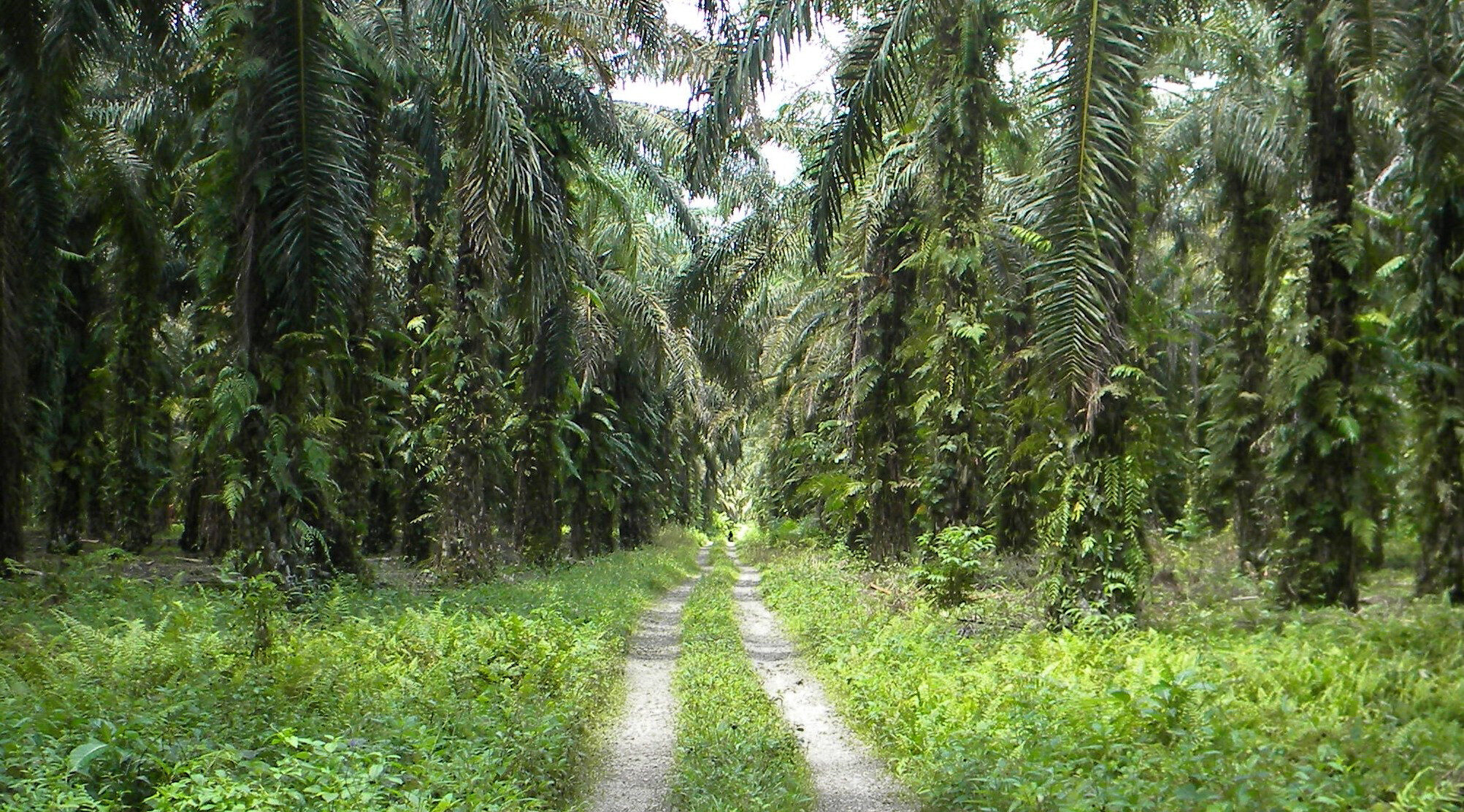
For example, oil palm has a distinctive star-shaped pattern that is easily identifiable when visually interpreting this high-resolution data. However, it may be necessary to do an on-the-ground visit to areas where good high-resolution data is not available, such as due to cloud cover or where the land use is not clear in the image. Specifically, tree crops covered by the EUDR such as cocoa can be difficult to distinguish from natural forest cover since they are often grown under the canopy of natural forests, which is captured in the satellite images.
The EUDR and beyond
Enforcement of the EUDR is an important step toward the protection of the world’s forests, and assessments against these requirements can be used to ensure that only deforestation-free commodities are entering the EU market. Although there are challenges to linking satellite data with the requirements of regulations such as the EUDR, a combination of open data sets and tools such as the tree cover loss data, the Natural Lands Map and GFW Pro can be used for transparent reporting against deforestation-free requirements.
However, there are still other challenges related to the EUDR.
Firstly, sellers in the EU market are expected to adopt potentially challenging and expensive monitoring approaches. Sufficient support must be provided to ensure that livelihoods — such as those of the many smallholder farmers and economies relying on these transactions — are protected. GFW’s free and easy-to-use platform makes monitoring data and tools available to those producers, and therefore is an important part of a set of programs and incentives that can support smallholders and prevent them from being excluded from the market.
Secondly, deforestation should be avoided in all forests, not just in areas where deforestation is linked to EU markets. The global nature of GFW’s data sets and the tailored monitoring approaches offered by GFW Pro pave the way for monitoring and enforcing other complimentary regulations and deforestation commitments.