Data is Helping Protect Threatened Forests and Biodiversity in Cameroon’s Mengamé Gorilla Sanctuary
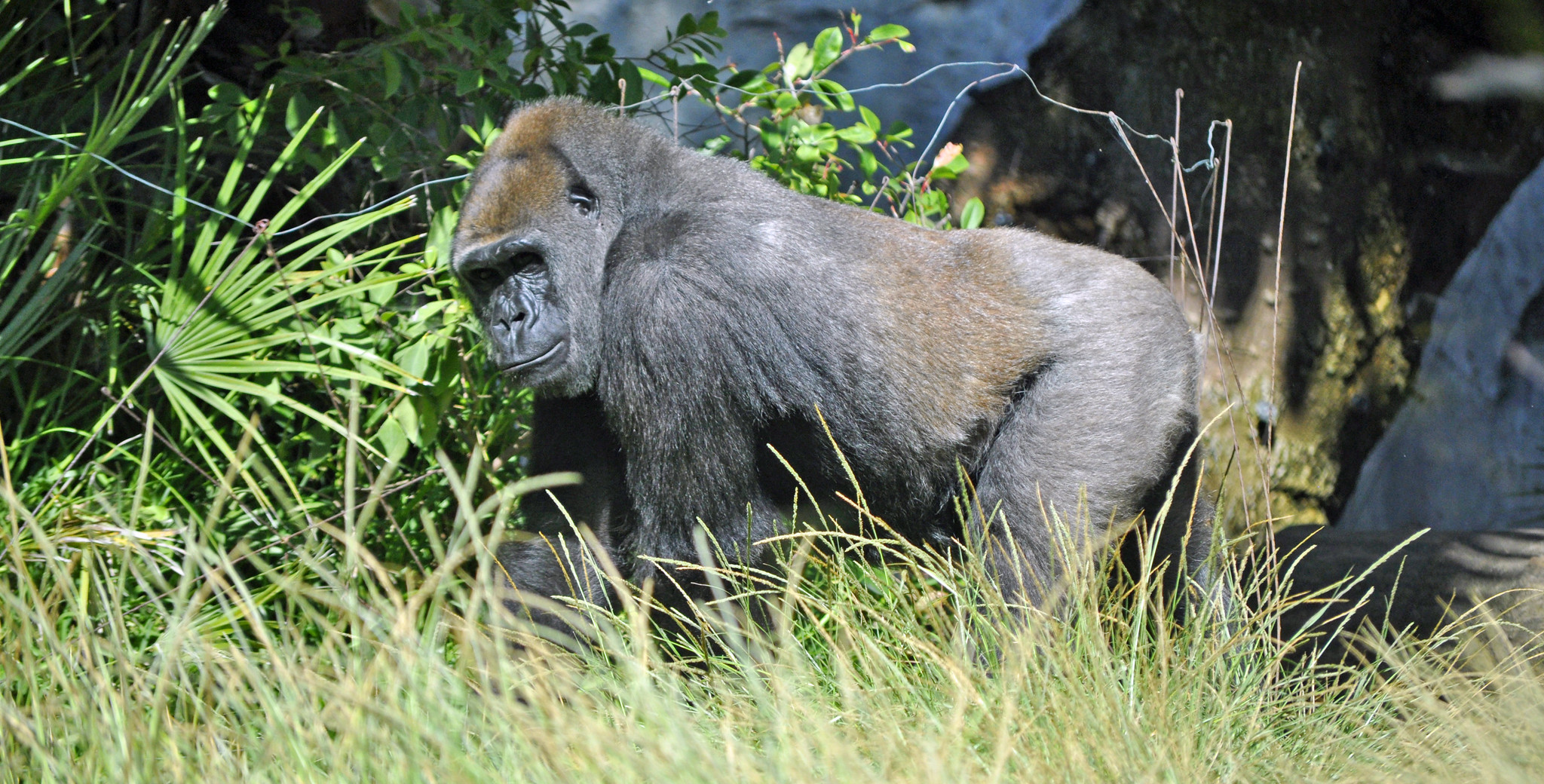
Western lowland gorilla. Credit: Heather Paul, Flickr
Cameroon has very rich biological diversity, housed within several ecosystems that are representative of the ecosystems of Africa — the reason Cameroon is often described as “Africa in miniature.” The nation’s biological diversity underpins its economy and has scientific and medicinal importance for Cameroon’s people.
In order to meet its commitments to protect the environment after the 1992 United Nations Conference on Environment and Development, and consequently its commitment to the Convention on Biological Diversity, objective 11 of Cameroon’s National Biodiversity Strategy and Action Plan calls for at least 30% of the national territory to be designated as protected areas, which aim to protect nature and biodiversity from human activities and pressures.
To this end, several protected areas (national parks, reserves, etc.) were established, including the Mengamé Gorilla Sanctuary. This sanctuary faces several threats including the loss of forest cover, which leads to fragmentation of the habitat found there.
Our organization, Action for Sustainable Development, works to respond to the increasing threat of deforestation in Mengamé. In 2023, we received a Global Forest Watch (GFW) Small Grants Fund (SGF) grant to help us monitor forests in the sanctuary. We found that forest loss over the last three years is increasing, and that a new management plan for the sanctuary based on better data is needed to protect the sanctuary’s forests and the biodiversity that depends on them.
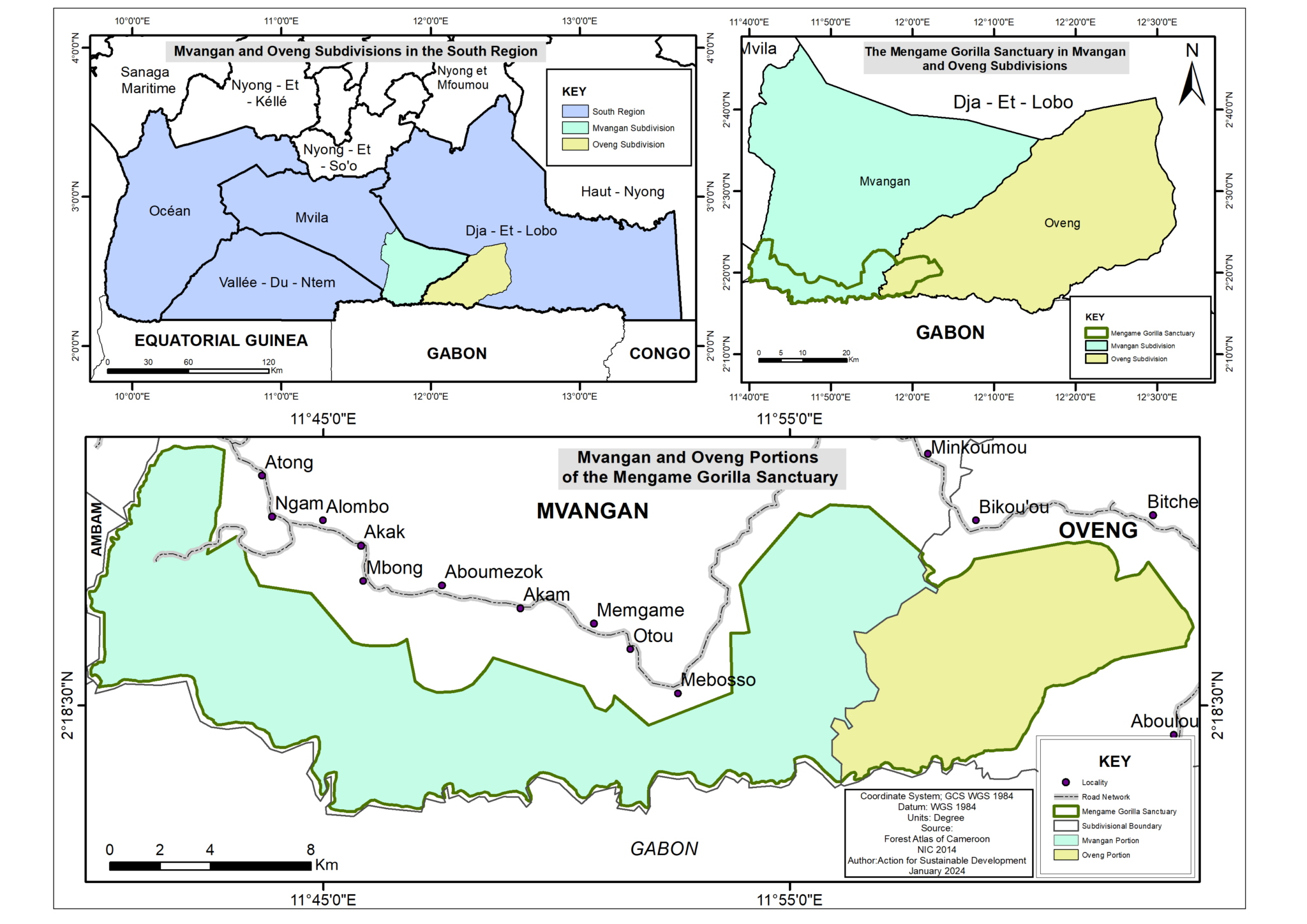
The Mengamé Gorilla Sanctuary
The Mengamé Gorilla Sanctuary (MGS) belongs to the Tri-national Dja-Odzala-Minkébé (TRIDOM) complex, a cross-border area encompassing 10% of the Congo Basin’s rainforests and 11 protected areas across Cameroon, Congo and Gabon. TRIDOM is a key area for the conservation of the biodiversity of the Congo Basin, including iconic large mammals such as elephants, chimpanzees and gorillas. The MGS is located in the equatorial forest zone in the southern part of Cameroon on the border with Gabon. It covers 26,780 hectares and straddles the districts of Mvangan in Mvila subdivision and Oveng district in Dja-et Lobo subdivision. The MGS is home to a diversity of wildlife including primates like the Western Lowland Gorilla, which is critically endangered due to human activities that have intensified over the years, such as deforestation leading to loss of habitat as well as poaching.
Satellite data reveals increasing loss of the sanctuary’s forest cover
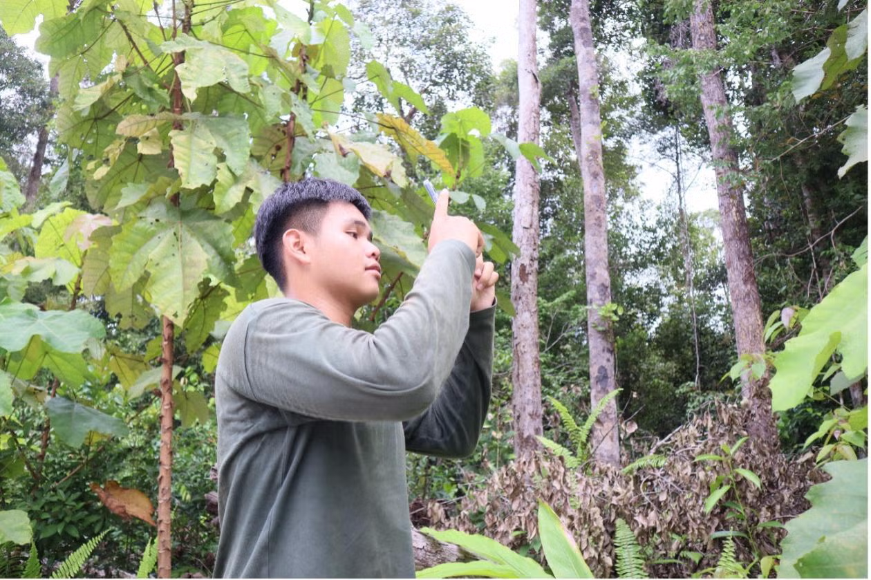
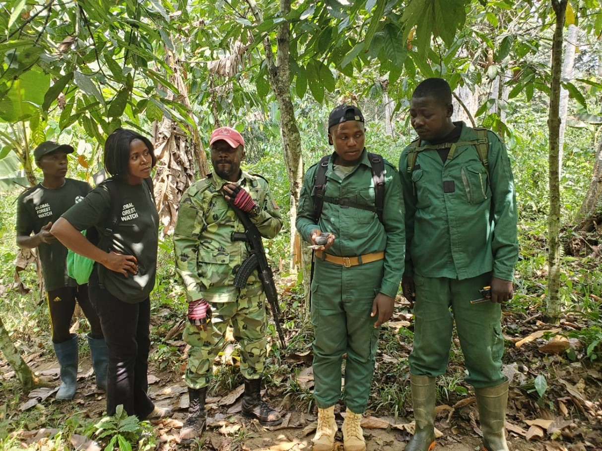
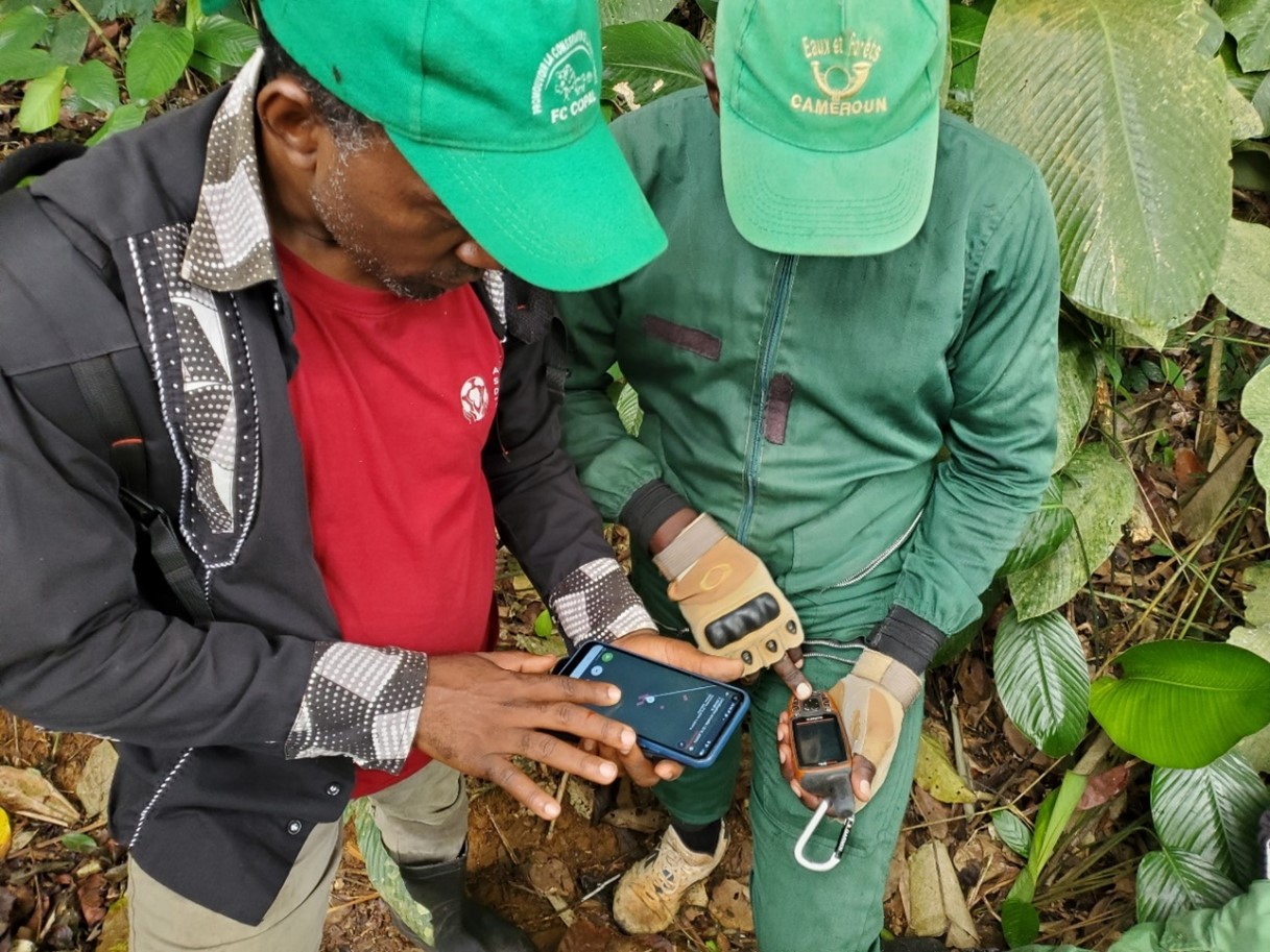
Action for Sustainable Development (ASD), a Cameroonian civil society organization, has been able to use the tools available from GFW to conduct satellite monitoring of forest cover change in protected areas. As part of our SGF project “Participatory monitoring of forest cover in and around the MGS,” we used GFW’s near-real-time integrated deforestation alerts to identify areas of forest loss, and supported park agents and others in the community to use GFW tools to investigate the alerts.
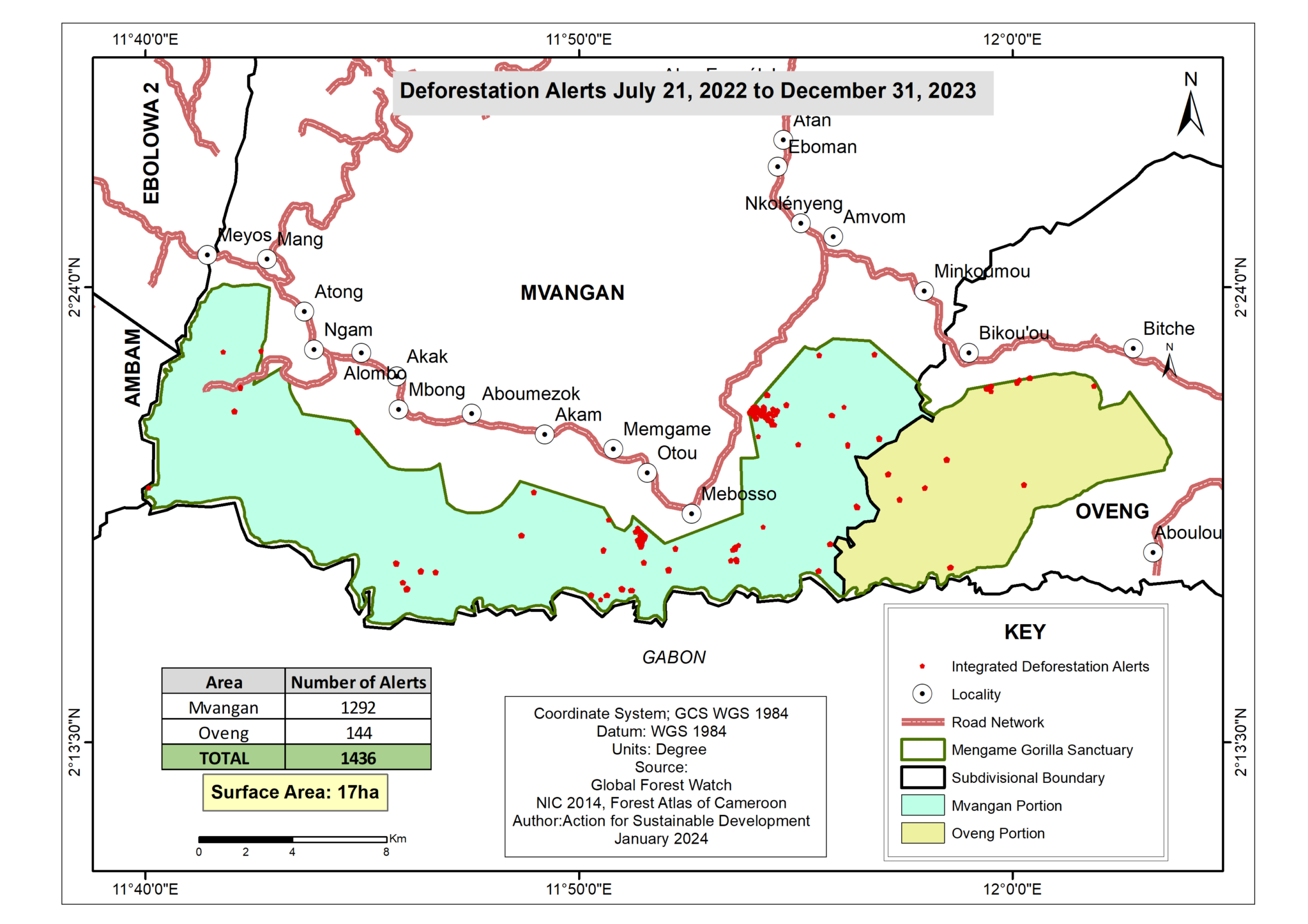
We analyzed alerts for two time periods over three years (2021-2023) and found that for the first period, from January 1, 2021 to July 20, 2022, more than 937 deforestation alerts were recorded totaling eight hectares of forest loss. The map below shows the distribution of these alerts in the two districts (896 alerts in the part of the sanctuary located in the Mvangan district and 41 alerts in the part of the sanctuary located in the Oveng district).
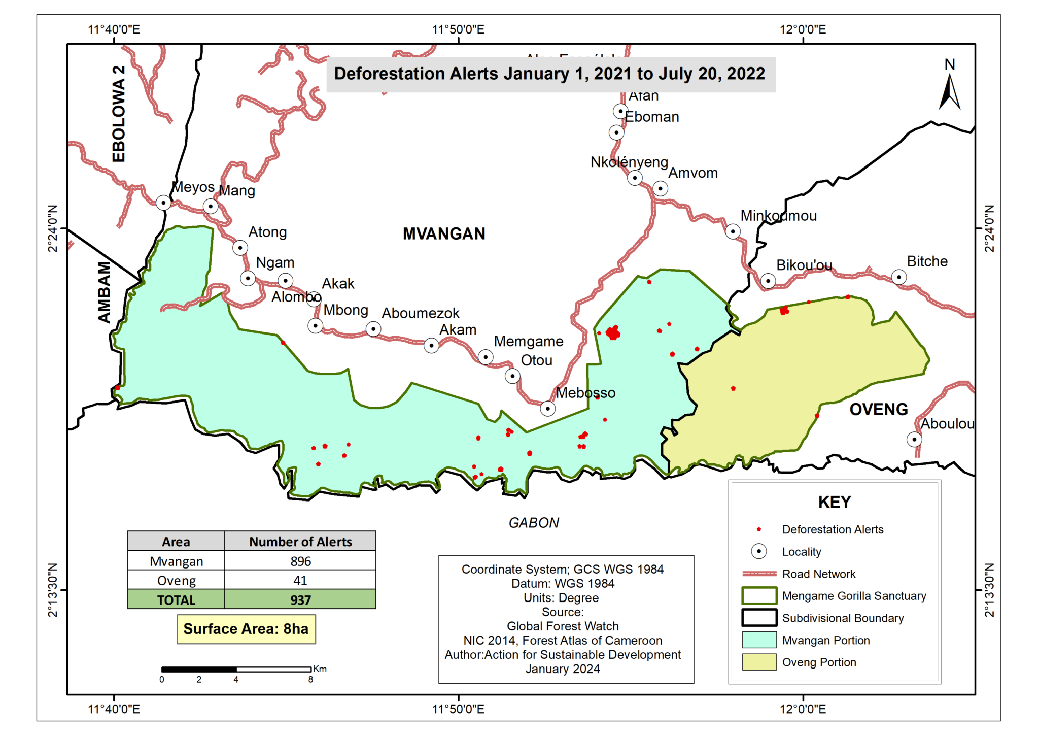
Likewise, for the second period between July 21, 2022 and December 31, 2023, more than 1,436 deforestation alerts were recorded, including 1,292 in the part of the sanctuary located in the Mvangan district and 144 in the part of the sanctuary located in the Oveng district. The total of these deforestation alerts represents a loss of 17 hectares of forest.
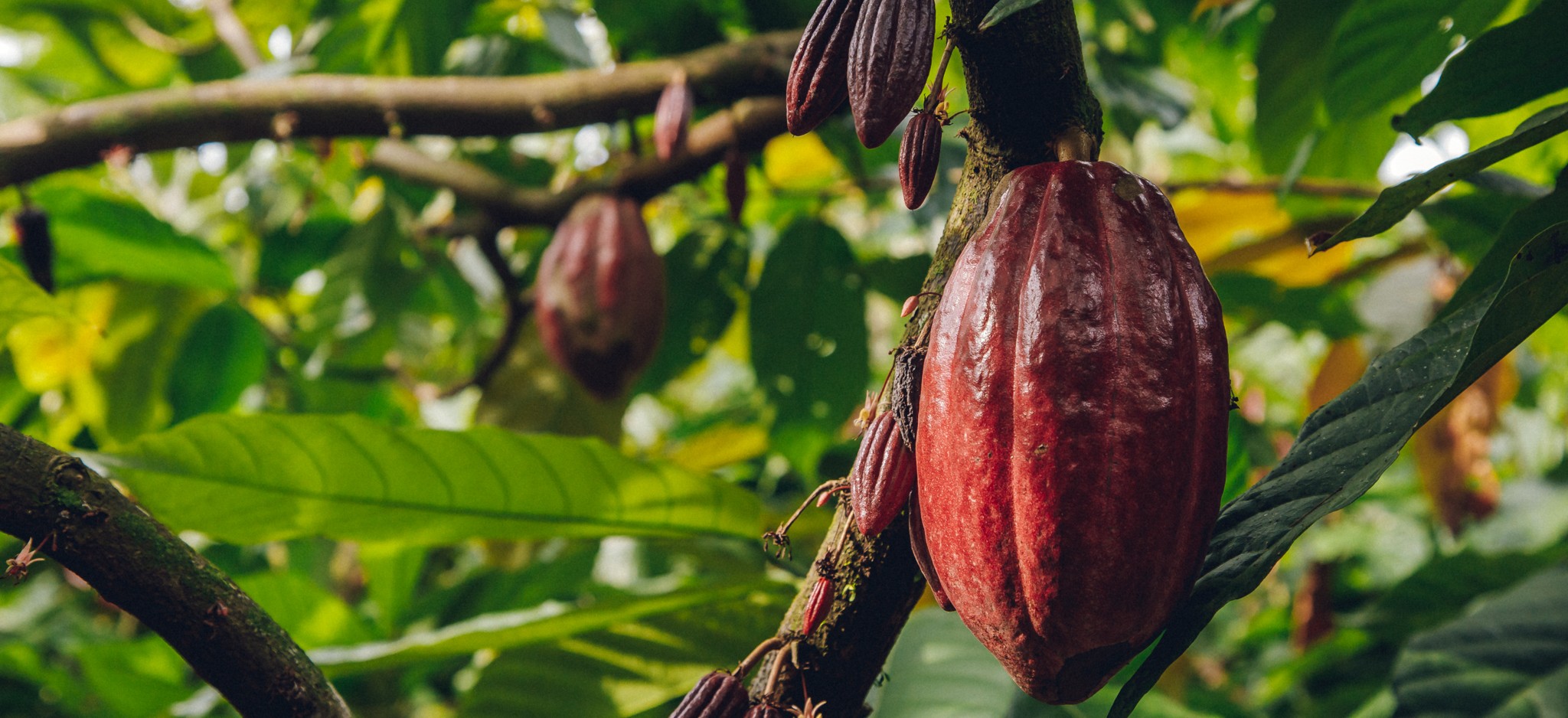
The Mengamé gorilla sanctuary has therefore already lost nearly 25 hectares of forest in just three years from 2021 to 2023. These findings indicate that, over time, anthropogenic activity is increasing in the sanctuary. Investigations carried out to determine the main causes of this loss of forest cover showed that this has been caused by the establishment or extension of agricultural plots (cocoa and banana plantations). This pressure is growing due to the increase in the price of cocoa on the international market — and cocoa is the main cash crop in this area. If nothing is done, the sanctuary will be severely depleted and degraded the next several years.
To protect the sanctuary, a new management plan is needed
To understand the motivations or reasons that lead local communities to set up their cocoa plantations and others in the sanctuary, our team conducted a survey as part of our project.
Two major reasons were mentioned by local communities to justify their actions:
The first reason is the lack of collaboration between local communities and conservation services. Indeed, 38% of the population thinks that they are not involved in the management of the sanctuary. There is almost no conservation activity within the sanctuary or ecotourism, appearing to local communities to have been abandoned for several years. Thus, they thought that the sanctuary was no longer a priority for the State. Our project has since succeeded in bringing together local communities, the conservation service and civil society organizations as part of a more participatory monitoring of the sanctuary.
The second reason is the fact that the space dedicated to the communities’ rural activities is becoming insufficient. 22% of local communities believe that the area dedicated to their activities is becoming insufficient given the rapid population growth. Yet despite these changes, the development and management plan for the sanctuary, which should be renewed every five years to better take into account the realities of all stakeholders, has not been updated since 2007. This plan provides information about the sanctuary based on uses, priorities, threats and more, but not only is it out of date, it is also based partially on data from the neighboring Kom National Park as there is insufficient data on the sanctuary itself. Furthermore, the demarcation of the boundaries of the sanctuary had not been effective in all the riverside villages, and currently the boundaries that had been demarcated are no longer visible.
Therefore, development of a new management plan for the sanctuary is needed. This plan should:
- Take into account the increase in population and suggest effective ways for the development of alternative income-generating activities for local communities
- Place emphasis on promoting ecotourism by developing infrastructure for this purpose
- Involve local communities in the participatory management of the sanctuary
- Provide updated data on biodiversity (fauna and flora species present and their densities, etc.)
- Place emphasis on transboundary management of the sanctuary
The MGS’s forests and the valuable biodiversity that depends on them can still be protected if the sanctuary implements a plan and manages the sanctuary based on recent, accurate data. The data collected by ASD using GFW tools is an important part of this and can help us preserve Mengamé Gorilla Sanctuary for years to come.
Learn more about ASD: Visit their website and follow them on Facebook, Twitter/X and LinkedIn.